ïŧŋïŧŋ
ïŧŋ
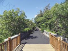
004km-la-vigne-a-velo-draguignan-trans-v01
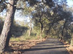
005km-la-vigne-a-velo-les-arcs-sainte-roseline-v01
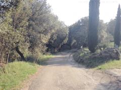
oustaoudaqui-les-laurons-fantroussieres-7km
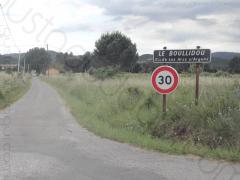
oustaoudaqui-le-bouillidou-saint-roch-10km
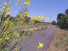
011km-la-vigne-a-velo-v01
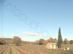
012km-les-arcs-gare-sncf-vigne-a-velo-le-bouillidou-v01
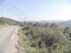
oustaoudaqui-taradeau-les-contes-15km
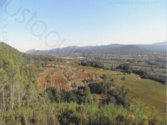
016km-beauveser-oppidum-fantroussieres-v01
oustaoudaqui-taradeau-les-nourradons-20km
oustaoudaqui-la-motte-les-valises-21km
027km-les-arcs-castel-diol-v01
043km-beauveser-taradel-gaye-pan-lorgues-ev8-flayosc-fantroussieres-v01
Below your selection of
12
routes
|
Type
Mountain Leisure
Location
Any
Sort by
Distance

Area : Provence Verte
Distance : 4 km
Difficulty Rating : 1/5
4 km flat ride on the section 5 of the famous greenway La Vigne à VÃĐlo (Vineyard by Bike).
Distance : 4 km
Difficulty Rating : 1/5
4 km flat ride on the section 5 of the famous greenway La Vigne à VÃĐlo (Vineyard by Bike).

Area : Argens
Distance : 5 km
Difficulty Rating : 2/5
5 km pretty flat ride - a few very short steep inclines near bridges or ways under the railbed and also in the Saint-Charles wood - on the section 2 of the famous greenway La Vigne à VÃĐlo (Vineyard by Bike).
Distance : 5 km
Difficulty Rating : 2/5
5 km pretty flat ride - a few very short steep inclines near bridges or ways under the railbed and also in the Saint-Charles wood - on the section 2 of the famous greenway La Vigne à VÃĐlo (Vineyard by Bike).

Area : Argens
Distance : 7 km
Difficulty Rating : 2/5
7 km ride to discover the bottom and the top of the village.
Distance : 7 km
Difficulty Rating : 2/5
7 km ride to discover the bottom and the top of the village.

Area : Argens
Distance : 10 km
Difficulty Rating : 1/5
10 km leisurely flat ride to discover the village and some small bicycle friendly roads nearby.
Distance : 10 km
Difficulty Rating : 1/5
10 km leisurely flat ride to discover the village and some small bicycle friendly roads nearby.

Area : Argens
Distance : 11 km
Difficulty Rating : 2/5
11 km pretty flat (a few very short steep sections) return ride on the famous greenway La Vigne à VÃĐlo (Vineyard by Bike).
Distance : 11 km
Difficulty Rating : 2/5
11 km pretty flat (a few very short steep sections) return ride on the famous greenway La Vigne à VÃĐlo (Vineyard by Bike).

Area : Argens
Distance : 12 km
Difficulty Rating : 2/5
12 km pretty flat ride combining back roads and the famous greenway La Vigne à VÃĐlo (Vineyard by Bike).
Distance : 12 km
Difficulty Rating : 2/5
12 km pretty flat ride combining back roads and the famous greenway La Vigne à VÃĐlo (Vineyard by Bike).

Area : Provence Verte
Distance : 15 km
Difficulty Rating : 2/5
13 km total. 5 km flat to warm up then 2 km uphill to get a nice overview. Nice back roads through St Martin chapel and Taradel Sarazin Tower then downhill to les Arcs.
Distance : 15 km
Difficulty Rating : 2/5
13 km total. 5 km flat to warm up then 2 km uphill to get a nice overview. Nice back roads through St Martin chapel and Taradel Sarazin Tower then downhill to les Arcs.

Area : Provence Verte
Distance : 16 km
Difficulty Rating : 3/5
16 km of tracks and small roads. Hillside (chemin de Beauveser) then uphill to the viewpoint (nice overview on Argens valley). Back to les Arcs through the forest on tracks and rural back roads
Distance : 16 km
Difficulty Rating : 3/5
16 km of tracks and small roads. Hillside (chemin de Beauveser) then uphill to the viewpoint (nice overview on Argens valley). Back to les Arcs through the forest on tracks and rural back roads

Area : Provence Verte
Distance : 20 km
Difficulty Rating : 2/5
20 km total. 5 km flat to warm up then 2 km uphill to get a nice overview. Nice back roads through St Martin chapel, Taradel Sarazin Tower, ChÃĒteau d'Ott vineyard and Mediterranean forest.
Distance : 20 km
Difficulty Rating : 2/5
20 km total. 5 km flat to warm up then 2 km uphill to get a nice overview. Nice back roads through St Martin chapel, Taradel Sarazin Tower, ChÃĒteau d'Ott vineyard and Mediterranean forest.

Area : Argens
Distance : 21 km
Difficulty Rating : 2/5
21 km pretty flat through Les Arcs, La Motte and Le Muy vineyards.
Distance : 21 km
Difficulty Rating : 2/5
21 km pretty flat through Les Arcs, La Motte and Le Muy vineyards.

Area : Maures
Distance : 27 km
Difficulty Rating : 4/5
Mainly off road cross country ride in the heart of the very wild Massif des Maures. 10 km climb after the bridge over the Aille river to reach the holy grail at alt. 320m.
Last section downhill on tough rocky track from Les CanebiÃĻres. Please read Tips for cyclists touring Provence, French Riviera and hinterland for this total change of scenery !

Area : Provence Verte
Distance : 43 km
Difficulty Rating : 3/5
All-inclusive paved and unpaved backroads, tracks (Chemin de Belveses along the Florieye river), tunnels and bridges (EuroVelo 8), fording, gorges (Gaye Pan)... Some differences in altitudes before to get to Sauve-Clare but it is indeed a really enjoyable loop with diverse scenery to explore.
Possible pit stops in Lorgues and Flayosc.
Mountain bike required although feasible with sturdy hybrid bicycle equipped with big tires.


